



Description
Software 'TZ Navigator' V5
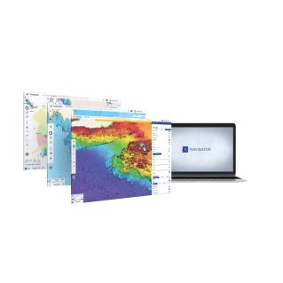
Marine navigation software. TZ Navigator is the dedicated navigation software for boaters, sailing or motor-powered, offering its users all the essential functions to organize and manage their outings at sea.
Screen and display
- From simple route plotting at home to creating a transatlantic routing, TZ Navigator offers you a complete set of tools meeting all your requirements: Boat GPS positioning, weather forecast display, worldwide tide database, route and waypoint management, AIS/ARPA function.
- Identify at a glance the front zones and their evolution over the coming hours and days thanks to particle weather display technology!
Features and technologies
- TZ Navigator is the most comfortable software thanks to its mapping engine with unmatched performance and easy-to-use interface.
- NEWS:
All revolutionary features of TZ MAPS are now available on TZ Navigator v5!
Compatibility
- Mapping, high-resolution satellite photos and 3D data are merged for optimal visualization of your navigation area.
- Have all navigation data throughout your route to anticipate your course and anchorages with the utmost precision.
- Compatible with Windows® 8.1 or Windows® 11, each license is valid for two PCs.
- TZ MAPS combines all data for navigation in optimal conditions: Raster, Vector, terrestrial information, high-resolution satellite photos, high-resolution bathymetry.
- Finally, for the purchase of a TZ MAPS area on TZ Navigator v5, use it free of charge on the TZ iBoat iOS app!
Size and waterproofing
- TZ MAPS also introduces new features that will quickly become essential to you: Community Maps, Bathyvision, Dynamic lights, Dynamic mooring, Smart search and Smart zone.
Usage advice
A computer with a positioning device (external or integrated GPS) is required. Check the minimum required configuration before purchase.
Technical characteristics
| Model | TZ Navigator software |
|---|