Description
TZ MAPS Wide Zone (1 year of updates included) - Not compatible with NavNet TZT, TZT2 and TZT3
Access the most reliable and comprehensive map data on TIMEZERO
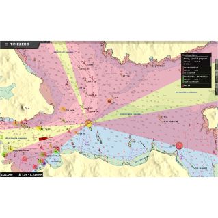
VECTOR or RASTER? Don't ask yourself that question! Whenever Raster and Vector formats are available, TZ MAPS will include both as standard. Thanks to our agreements with numerous hydrographic services, TZ MAPS offers coverage for Europe, North America, the Caribbean and the Pacific. Each area includes at least vector data, while raster data (scanned and georeferenced paper charts) is dependent on national hydrographic services. An excellent way of comparing data to make sure you're getting the best information available. We've put a lot of effort into our color palettes, to ensure that the display is both pleasing to the eye and simple and intuitive to read. High-resolution satellite photos are also included as standard.
Continuously updated nautical charts
When you purchase a zone, regular updates are included for one year. To update your charts, simply click on the 'update' button available on all our products. After one year, you can choose to subscribe to our permanent update service via our online store https://store.mytimezero.com/. Finally, when you purchase a TZ MAPS zone for TZ Navigator or TZ Professional, you can use it free of charge on our TZ iBoat iOS application.
Features
Important note: TZ MAPS maps cannot be shared free of charge with NavNet TZtouch1, 2 and 3. We therefore recommend MM3D charts for use with TZ Navigator v5 and TZ Professional v5 in combination with NavNet TZtouch3.